1.2. Blue Green Network
Aus Pattern Language Wiki
(Weitergeleitet von .../Blue Green Network)
Settlements that follow the pattern of a Polycentric Region will also adapt to the terrain of the land, its watershed and vegetation patterns.
Problem-statement: A region that does not adapt its form to its watershed patterns cannot be sustainable.
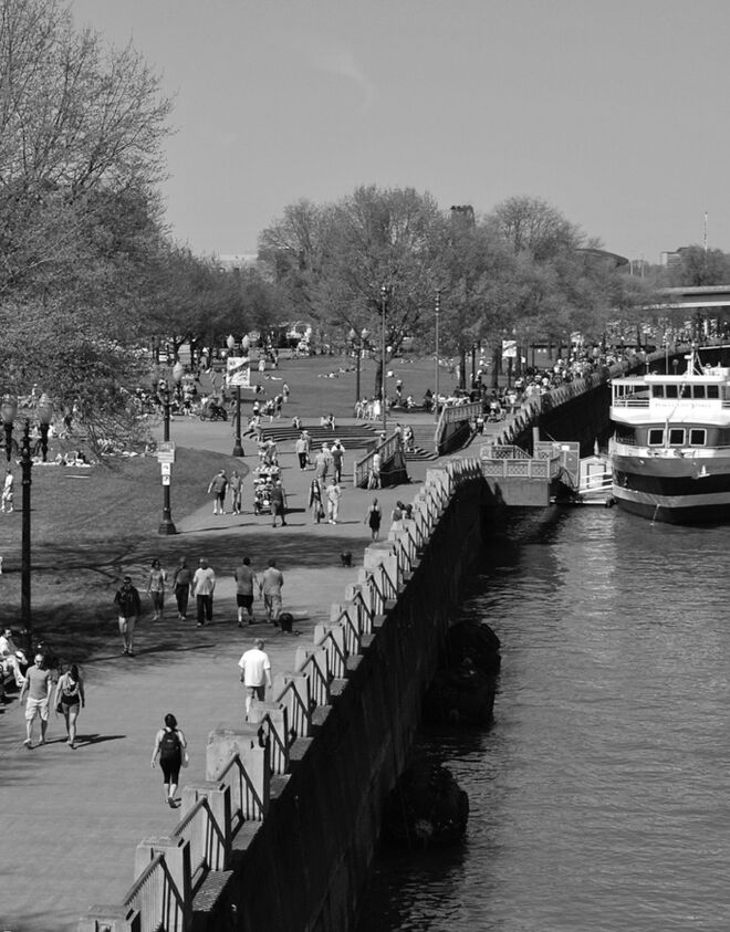
Discussion: Every settlement area, no matter how arid, has a hydrology at some scale. In recent decades, it has been common to pipe over the natural system of hydrology, but this is doubly destructive. First, it fails to allow the natural systems to function as they can to clean the water, recharge the groundwater, and support vegetation with natural irrigation. Second, it deprives the human community of an important quality of life asset, and sense of connection to their own regional ecosystems.
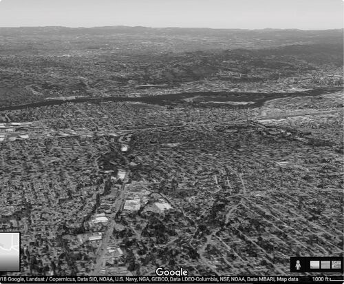
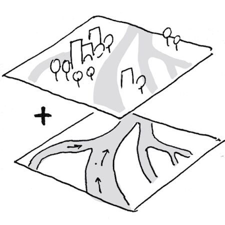
In order to work with a region’s hydrology, it is vital to recognize its network connectivity through mapping, and then to lay out settlement patterns such as streets and infrastructure in response to its “blue-green network” — that is, its network of creeks, watersheds and vegetation corridors. These usually offer segments that can become important blue-green corridors for walking, cycling, recreation and vehicular transportation (with proper mitigation of danger, noise, emissions and other impacts) — see Urban Greenway.
In the 20th century, we failed to understand the importance of these blue-green networks, and their potential role as a “cooperating network” with human movement networks. We failed also to understand the importance of blue-green networks in providing “ecosystem services,” notably the improvement of water quality.² Rather than negotiate a co-existence between these two systems, we allowed human movement systems like streets to dominate and even replace blue-green networks with pipes and concrete ditches. Now we are paying the price for this short-sightedness. We have begun to change our policies and practices to create nested, interacting urban networks incorporating blue-green networks within them.
At the same time we must recognize that, while the blue-green network of an urbanized area must be ecologically functional with regard to its ecosystem services and its role in urban wildlife habitats, the primary function of urban regions is to be urban — that is, to establish a pattern that is sufficiently compact to avoid sprawl and to protect surrounding ecologies. As the British Town Planner Thomas Sharp put it, “the true way to save the countryside is to build true sheerly urban towns.”
Therefore:
Lay out the settlement with the pattern of blue (water courses) and green (vegetation corridors and watersheds) networks.
Identify key corridors of the Blue Green Network as potential locations for an Urban Greenway or Multi-Way Boulevard
¹ See for example De Vleeschauwer, K., Weustenraad, J., Nolf, C., Wolfs, V., De Meulder, B., Shannon, K., & Willems, P. (2014). Green–blue water in the city: Quantification of impact of source control versus end-of-pipe solutions on sewer and river floods. Water Science and Technology, 70(11), 1825-1837.
² This pattern is closely related to Goal 6 of the Sustainable Development Goals on safe water and sanitation (adopted by all members of the UN General Assembly in 2015). There are a number of resources that can be consulted for additional information. See for example the World Bank report on water quality and the role of cities, Quality Unknown, available free for download at https://openknowledge.worldbank.org/bitstream/handle/10986/32245/9781464814594.pdf?sequence=8&isAllowed=y. As the report concludes, “The world faces an invisible crisis of water quality. Its impacts are wider, deeper, and more uncertain than previously thought and require urgent attention. While much attention has focused on water quantity — too much water, in the case of floods; too little water, in the case of droughts — water quality has attracted significantly less consideration… Water quality challenges are not unique to developing countries but universal across rich and poor countries alike. High-income status does not confer immunity - challenges with pollutants grow alongside GDP. And as countries develop, the cocktail of chemicals and vectors they contend with change — from fecal bacteria to nitrogen to pharmaceuticals and plastics, for example. What we think of as safe may be far from it.” See also a report by the European Union: “Green infrastructure, as defined by the European Union Green Infrastructure Strategy 2013 is 'a strategically planned network of natural and semi-natural areas with other environmental features designed and managed to deliver a wide range of ecosystem services’.” https://webgate.ec.europa.eu/greencitytool/resources/docs/guidance/nature.pdf
Mehaffy, M. et al. (2020). BLUE-GREEN NETWORK (pattern). In A New Pattern Language for Growing Regions. The Dalles: Sustasis Press. Available at https://pattern-language.wiki/.../1.2._Blue_Green_Network
SECTION I:
PATTERNS OF SCALE
1. REGIONAL PATTERNS
Define the large-scale spatial organization…
1.4. 400M THROUGH STREET NETWORK
2. URBAN PATTERNS
Establish essential urban characteristics…
3. STREET PATTERNS
Identify and allocate street types…
4. NEIGHBORHOOD PATTERNS
Define neighborhood-scale elements…
5. SPECIAL USE PATTERNS
Integrate unique urban elements with care…
6. PUBLIC SPACE PATTERNS
Establish the character of the crucial public realm…
7. BLOCK AND PLOT PATTERNS
Lay out the detailed structure of property lines…
8. STREETSCAPE PATTERNS
Configure the street as a welcoming place…
9. BUILDING PATTERNS
Lay out appropriate urban buildings…
10. BUILDING EDGE PATTERNS
Create interior and exterior connectivity…
10.1. INDOOR-OUTDOOR AMBIGUITY
SECTION II:
PATTERNS OF MULTIPLE SCALE
11. GEOMETRIC PATTERNS
Build in coherent geometries at all scales…
11.2. SMALL GROUPS OF ELEMENTS
12. AFFORDANCE PATTERNS
Build in user capacity to shape the environment…
13. RETROFIT PATTERNS
Revitalize and improve existing urban assets …
14. INFORMAL GROWTH PATTERNS
Accommodate “bottom-up” urban growth…
15. CONSTRUCTION PATTERNS
Use the building process to enrich the result…
SECTION III:
PATTERNS OF PROCESS
16. IMPLEMENTATION TOOL PATTERNS
Use tools to achieve successful results…
16.2. ENTITLEMENT STREAMLINING
16.3. NEIGHBORHOOD PLANNING CENTER
17. PROJECT ECONOMICS PATTERNS
Create flows of money that support urban quality…
17.4. ECONOMIES OF PLACE AND DIFFERENTIATION
18. PLACE GOVERNANCE PATTERNS
Processes for making and managing places…
18.3. PUBLIC-PRIVATE PLACE MANAGEMENT
19. AFFORDABILITY PATTERNS
Build in affordability for all incomes…
19.1. INTEGRATED AFFORDABILITY
20. NEW TECHNOLOGY PATTERNS
Integrate new systems without damaging old ones…
20.2. RESPONSIVE TRANSPORTATION NETWORK COMPANY


