3.3. Avenue
Aus Pattern Language Wiki
(Weitergeleitet von .../Avenue)
In laying out the 400M Through Street Network, create a sub-network of streets between the Mobility Corridor and Multi-Way Boulevard.
Problem-statement: People need streets that allow their vehicles to travel longer distances safely at moderate speed, while still giving good access to the buildings and neighborhoods along them.
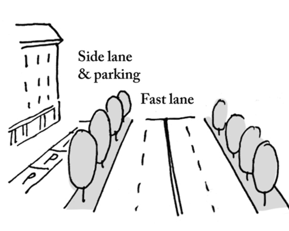
Discussion:: Multi-way boulevards are a good solution for large volumes of traffic, but many other streets within the network do not require multiple separated lanes. It is sufficient for these streets to have a single group of lanes — typically no more than two in each direction — and on-street parking to provide protection to pedestrians, and to slow traffic to moderate speeds (typically 30 kilometers per hour, or 20 miles per hour). If these streets are spaced (together with multi-way boulevards) at a regular 400m interval, they can handle ample volumes of traffic without negatively impacting pedestrian safety and neighborhood livability.
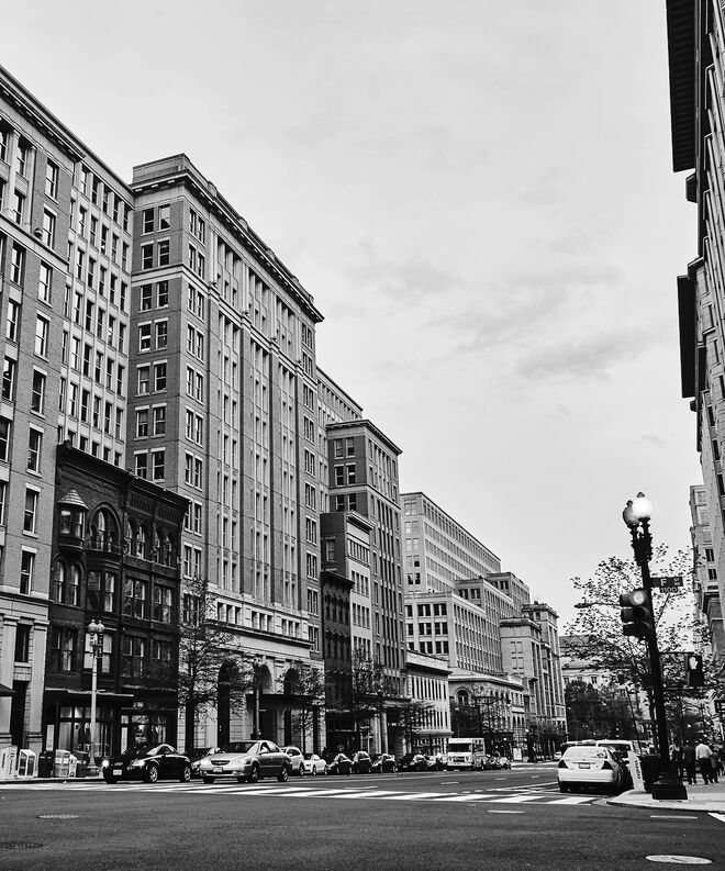
In a well-functioning multi-modal avenue, on-street parking slows traffic down and provides a buffer, making it possible for pedestrians to navigate the avenue safely. Unfortunately, transportation engineers have too often removed on-street parking in order to speed up traffic flow. This action will severely compromise the pedestrian component of avenues. Transportation engineers should recognize that they need not handle avenue traffic at the same high speeds as multi-way boulevards and other mobility corridors. Indeed, a growing movement in “context-sensitive design” (also called “complete streets”) is arguing for a design speed for avenues and other local streets of no more than about 30 kilometers per hour, or 20 miles per hour.¹
It is not only the street itself that must be designed carefully, but also the streetscape, building frontages, and non-vehicular circulation zones (e.g. for pedestrians and bikes). There might be spots where fast traffic passes close to pedestrians, and these need protection with attractively designed bollards. Bicycle pathways need to be carefully designed to avoid car doors as well as pedestrians, and also to avoid effectively widening the street. (This generally means any separate bike lane needs to go next to the sidewalk, not in the street.) Building entrances need to be close to the street, with frequently spaced locations. The street must be seen as a system, with all of these components combined and integrated.²
Therefore:
Alternate multi-way boulevards with a network of avenues within the 400M spacing system. Provide on-street parking, and limit lanes to no more than two in each direction.
Develop each area between avenues as a Pedestrian Sanctuary, incorporating the pattern Shared Space Lane…
¹ See for example LaPlante, J., & McCann, B. (2008). Complete streets: We can get there from here. ITE Journal, 78(5), 24.
² One approach to ensuring that the components of the streetscape, including the building elevations, are coordinated into a “complete street” regime is the use of a Form-Based Code. See for example Talen, E. (2009). Design by the rules: The historical underpinnings of form-based codes. Journal of the American Planning Association, 75(2), 144-160.
Mehaffy, M. et al. (2020). AVENUE (pattern). In A New Pattern Language for Growing Regions. The Dalles: Sustasis Press. Available at https://pattern-language.wiki/.../Avenue
SECTION I:
PATTERNS OF SCALE
1. REGIONAL PATTERNS
Define the large-scale spatial organization…
1.4. 400M THROUGH STREET NETWORK
2. URBAN PATTERNS
Establish essential urban characteristics…
3. STREET PATTERNS
Identify and allocate street types…
4. NEIGHBORHOOD PATTERNS
Define neighborhood-scale elements…
5. SPECIAL USE PATTERNS
Integrate unique urban elements with care…
6. PUBLIC SPACE PATTERNS
Establish the character of the crucial public realm…
7. BLOCK AND PLOT PATTERNS
Lay out the detailed structure of property lines…
8. STREETSCAPE PATTERNS
Configure the street as a welcoming place…
9. BUILDING PATTERNS
Lay out appropriate urban buildings…
10. BUILDING EDGE PATTERNS
Create interior and exterior connectivity…
10.1. INDOOR-OUTDOOR AMBIGUITY
SECTION II:
PATTERNS OF MULTIPLE SCALE
11. GEOMETRIC PATTERNS
Build in coherent geometries at all scales…
11.2. SMALL GROUPS OF ELEMENTS
12. AFFORDANCE PATTERNS
Build in user capacity to shape the environment…
13. RETROFIT PATTERNS
Revitalize and improve existing urban assets …
14. INFORMAL GROWTH PATTERNS
Accommodate “bottom-up” urban growth…
15. CONSTRUCTION PATTERNS
Use the building process to enrich the result…
SECTION III:
PATTERNS OF PROCESS
16. IMPLEMENTATION TOOL PATTERNS
Use tools to achieve successful results…
16.2. ENTITLEMENT STREAMLINING
16.3. NEIGHBORHOOD PLANNING CENTER
17. PROJECT ECONOMICS PATTERNS
Create flows of money that support urban quality…
17.4. ECONOMIES OF PLACE AND DIFFERENTIATION
18. PLACE GOVERNANCE PATTERNS
Processes for making and managing places…
18.3. PUBLIC-PRIVATE PLACE MANAGEMENT
19. AFFORDABILITY PATTERNS
Build in affordability for all incomes…
19.1. INTEGRATED AFFORDABILITY
20. NEW TECHNOLOGY PATTERNS
Integrate new systems without damaging old ones…
20.2. RESPONSIVE TRANSPORTATION NETWORK COMPANY

